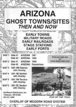
Each state is represented by a series of maps showing what the state looked like in the late 1800s with a clear overlay showing modern roads and highways. Great for locating old Northern California ghost town sites, early roads, railroads and forts. Each set contains several maps.
Unique map series shows changes to gold & gem fields over 100 years. Each map package includes current USGS maps along with antique turn-of-the-twentieth century maps for comparison.
Overlay Modern Road System over Historical Maps and find Early Towns, Military Roads, Early Railroads, and Early Forts!
Map sections when combined cover then entire state of Arizona.
See picture 2 for an example of the maps with use of overlays
Using the Overlays:
The overlay, which is used over the map of Arizona, 1881, (maps 3,4,5 & 6) has been reproduced from a modern map. The purpose is to show the changes in the state over a period of 100 years! Place names may appear in 1881 which are absent of the current map. Some of the locations may have been early stage stations, mining camps, ranches or early town sites later abandoned.
The different locations noted in boundaries, landmarks and place names are evident.
A great historical reference guide to find these old historical areas!